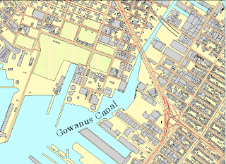
The above image is an example of the planimetric map. It is a two dimensional image showing only the horizontal position of features on the earth's surface. These may include natural physical features or man made structures such as roads or buildings. It is important to note that these maps are not topographic and are frequently in planning models such as landscape designs for urban areas.

No comments:
Post a Comment